Powering the Future of Robotics with SWEGEO
Robotics is no longer a vision of the future – it’s here now, reshaping industries and everyday life. From autonomous vehicles navigating our streets, to precision agriculture equipment tending fields, to automated machines improving efficiency in warehouses, robots are transforming how tasks are performed.
As these robots leave controlled environments and operate in the real world, one factor becomes critically important: knowing exactly where they are at all times. This is where Global Navigation Satellite System (GNSS) technology steps in as a foundational element of modern robotics. SWEGEO, a leader in advanced GNSS solutions, is at the forefront of this revolution. By providing high-precision positioning systems and seamless integration support, SWEGEO is helping to power the next generation of robots – making them smarter, safer, and more capable than ever.
For any mobile robot, whether it’s a self-driving car or a crop-inspecting drone, accurate positioning is like the robot’s sense of location. Without precise positioning, a robot cannot reliably navigate to a target, avoid obstacles effectively, or coordinate with other machines. Traditional GPS might give a location within a few meters – fine for driving directions on a smartphone, but not nearly enough for a robot that needs to operate with pinpoint accuracy. For instance, an autonomous drone landing on a charging pad or a robotic tractor following crop rows must know its position within centimeters.
High-precision GNSS (often achieved through techniques like RTK corrections or multi-constellation receivers) provides this level of accuracy. It enables robots to follow predetermined paths exactly, repeat tasks in the same location day after day, and confidently maneuver in dynamic outdoor environments. In essence, precise GNSS positioning acts as the backbone of outdoor robotic navigation, ensuring these machines have a consistent and reliable frame of reference in the physical world.
SWEGEO specializes in GNSS-based positioning systems tailored for the demanding needs of robotics and autonomous systems. Unlike generic GPS units, SWEGEO’s receivers and antennas are designed to deliver survey-grade accuracy and robust performance even in challenging conditions. They support signals from multiple satellite constellations (GPS, GLONASS, Galileo, BeiDou, and more), which means a robot can access dozens of satellites at once for better coverage and reliability. More satellites translate to position fixes that hold up even if some signals are blocked by buildings or trees. Additionally, SWEGEO’s hardware often supports real-time kinematic (RTK) and other correction services, allowing a robot to achieve centimeter-level accuracy in real time. This is crucial for tasks like automated precision agriculture or drone surveying where even minor deviations can be problematic.
What truly sets SWEGEO apart is not just the hardware, but the integration support that comes with it. At SWEGEO, the engineering team understands that a GNSS receiver is one part of a bigger robotic ecosystem. They provide out-of-the-box compatibility with popular robotics frameworks – notably the Robot Operating System (ROS). This means developers can easily connect SWEGEO’s GNSS devices into their robot’s ROS-based software pipeline. Through provided ROS drivers and APIs, the GNSS data (like latitude, longitude, altitude, velocity) flows seamlessly into the robot’s brain. This plug-and-play integration empowers developers and engineers to quickly build smarter robots without having to wrangle low-level data protocols or write custom drivers from scratch. The upshot is that robotics teams can focus on their application – be it a self-driving rover or a flying drone – while trusting SWEGEO’s positioning system to deliver accurate and reliable location data in the background.
In robotics, timing is everything. A robot makes decisions based on the data it receives from sensors at every moment. If there’s lag or inaccuracy in that data, the decisions (like stopping for an obstacle or turning along a path) could be off, potentially causing errors or safety issues. SWEGEO’s GNSS technologies are built for real-time performance. They output data at high update rates (often many times per second) and with low latency, ensuring that a robot’s control system is always working with up-to-the-second location information. For example, consider an autonomous delivery robot navigating a complex outdoor environment – as it moves, it constantly checks its position against a planned route. With real-time GNSS updates, the robot can immediately detect if it’s even a few centimeters off course and correct its path smoothly.
One of the great challenges in robotics is maintaining navigation capabilities as a robot moves between outdoor and indoor environments. Outdoor navigation is where GNSS shines – open sky allows satellite signals to provide absolute positioning. However, once a robot goes indoors or underground, GNSS signals can fade or disappear entirely. SWEGEO recognizes this challenge and addresses it by supporting hybrid navigation approaches. For outdoor navigation, SWEGEO’s GNSS delivers the precise global coordinates that robots need. For indoor scenarios (where GPS or GNSS isn’t available or reliable), robots must rely on other technologies such as visual SLAM (Simultaneous Localization and Mapping with cameras), LiDAR mapping, ultrawideband radio beacons, or inertial navigation systems.
The transition between outdoor GNSS navigation and indoor navigation can be seamless when the systems are properly integrated. For instance, an autonomous drone equipped with SWEGEO technology could use GNSS to fly to a building, then switch to LiDAR-based localization inside the structure. SWEGEO’s platform ensures that as long as the robot is under GNSS coverage, it receives the best possible positioning data. And when GNSS is not available, the system can flag the loss of signal so that the robot’s software knows to rely on alternate sensors. Furthermore, SWEGEO also offers solutions like GNSS/INS (Inertial Navigation System) integration – coupling satellite positioning with accelerometers and gyroscopes. A GNSS/INS combo can carry a robot through short GNSS outages (like going through a tunnel or briefly inside a facility) by dead-reckoning its position based on last known coordinates and inertial movement, then re-calibrating when GNSS signals return. This kind of resilience is key for real-world robots that cannot afford to get “lost” when GPS drops out.
SWEGEO’s high-precision positioning unlocks tremendous possibilities across various sectors:
- Autonomous Vehicles and Industrial Automation: Self-driving cars, mining trucks, and port automation vehicles rely on exact positioning to operate safely. In these cases, GNSS data helps vehicles stay in the correct lane or designated path and maintain safe distances. SWEGEO’s technology can provide the lane-level accuracy and reliability needed for advanced driver-assistance systems (ADAS) and fully autonomous driving in controlled industrial zones. Similarly, automated guided vehicles (AGVs) in large outdoor factories or container yards use GNSS to navigate vast areas where indoor infrastructure like magnets or QR codes aren’t feasible.
- Drones and UAVs: Drones used for surveying, deliveries, or inspections depend on GNSS for navigation and stability. A drone equipped with SWEGEO’s positioning system can hover accurately at a fixed point (for example, to inspect a specific spot on a wind turbine), follow complex waypoints over long distances, and return to its launch point with minimal error. The real-time kinematic accuracy also means that data collected by the drone (like aerial maps or 3D models) is extremely precise geospatially, which is vital for surveying and mapping applications.
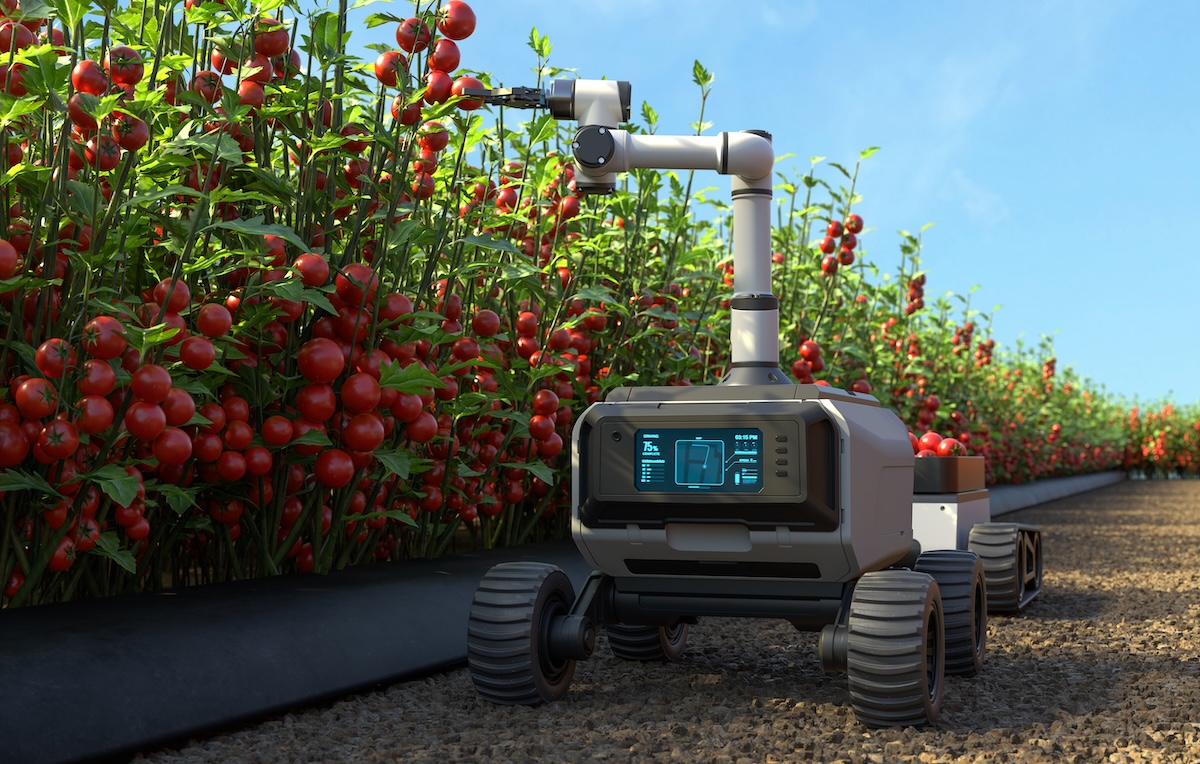
- Agricultural Robotics: Agriculture has embraced robotics in the form of autonomous tractors, sprayers, and harvesters. These machines utilize high-precision GNSS to follow exact paths in the field – ensuring every seed is planted in the correct spot and every fertilizer pass aligns with previous ones. SWEGEO’s GNSS receivers, with their rugged design and accuracy, enable precision agriculture techniques such as controlled traffic farming (where tractors drive in the same tracks to avoid compacting soil elsewhere) and variable rate application (where the exact location is used to apply different seed or fertilizer rates). The end result is higher yields and more efficient use of resources, powered by the combination of robotics and trustworthy positioning.
- Industrial and Warehouse Robots: Even within large warehouses or storage yards, robots are moving goods and materials. In some cases, these environments can use GNSS if they are open to the sky (like a lumber yard or container port). Where they can, SWEGEO’s systems guide robots to the correct storage location or loading dock with minimal human input. In indoor warehouses, GPS might not be available, but robots can still benefit from the methodologies SWEGEO uses – for example, high-frequency data updates and sensor fusion are as applicable to indoor systems (with alternate positioning tech) as they are to outdoor GNSS. SWEGEO’s ethos of reliable positioning and integration carries over regardless of environment.
Powering the Future of Robotics with SWEGEO
Robotics is no longer a vision of the future – it’s here now, reshaping industries and everyday life. From autonomous vehicles navigating our streets, to precision agriculture equipment tending fields, to automated machines improving efficiency in warehouses, robots are transforming how tasks are performed.
As these robots leave controlled environments and operate in the real world, one factor becomes critically important: knowing exactly where they are at all times. This is where Global Navigation Satellite System (GNSS) technology steps in as a foundational element of modern robotics. SWEGEO, a leader in advanced GNSS solutions, is at the forefront of this revolution. By providing high-precision positioning systems and seamless integration support, SWEGEO is helping to power the next generation of robots – making them smarter, safer, and more capable than ever.
For any mobile robot, whether it’s a self-driving car or a crop-inspecting drone, accurate positioning is like the robot’s sense of location. Without precise positioning, a robot cannot reliably navigate to a target, avoid obstacles effectively, or coordinate with other machines. Traditional GPS might give a location within a few meters – fine for driving directions on a smartphone, but not nearly enough for a robot that needs to operate with pinpoint accuracy. For instance, an autonomous drone landing on a charging pad or a robotic tractor following crop rows must know its position within centimeters.
High-precision GNSS (often achieved through techniques like RTK corrections or multi-constellation receivers) provides this level of accuracy. It enables robots to follow predetermined paths exactly, repeat tasks in the same location day after day, and confidently maneuver in dynamic outdoor environments. In essence, precise GNSS positioning acts as the backbone of outdoor robotic navigation, ensuring these machines have a consistent and reliable frame of reference in the physical world.
SWEGEO specializes in GNSS-based positioning systems tailored for the demanding needs of robotics and autonomous systems. Unlike generic GPS units, SWEGEO’s receivers and antennas are designed to deliver survey-grade accuracy and robust performance even in challenging conditions. They support signals from multiple satellite constellations (GPS, GLONASS, Galileo, BeiDou, and more), which means a robot can access dozens of satellites at once for better coverage and reliability. More satellites translate to position fixes that hold up even if some signals are blocked by buildings or trees. Additionally, SWEGEO’s hardware often supports real-time kinematic (RTK) and other correction services, allowing a robot to achieve centimeter-level accuracy in real time. This is crucial for tasks like automated precision agriculture or drone surveying where even minor deviations can be problematic.
What truly sets SWEGEO apart is not just the hardware, but the integration support that comes with it. At SWEGEO, the engineering team understands that a GNSS receiver is one part of a bigger robotic ecosystem. They provide out-of-the-box compatibility with popular robotics frameworks – notably the Robot Operating System (ROS). This means developers can easily connect SWEGEO’s GNSS devices into their robot’s ROS-based software pipeline. Through provided ROS drivers and APIs, the GNSS data (like latitude, longitude, altitude, velocity) flows seamlessly into the robot’s brain. This plug-and-play integration empowers developers and engineers to quickly build smarter robots without having to wrangle low-level data protocols or write custom drivers from scratch. The upshot is that robotics teams can focus on their application – be it a self-driving rover or a flying drone – while trusting SWEGEO’s positioning system to deliver accurate and reliable location data in the background.
In robotics, timing is everything. A robot makes decisions based on the data it receives from sensors at every moment. If there’s lag or inaccuracy in that data, the decisions (like stopping for an obstacle or turning along a path) could be off, potentially causing errors or safety issues. SWEGEO’s GNSS technologies are built for real-time performance. They output data at high update rates (often many times per second) and with low latency, ensuring that a robot’s control system is always working with up-to-the-second location information. For example, consider an autonomous delivery robot navigating a complex outdoor environment – as it moves, it constantly checks its position against a planned route. With real-time GNSS updates, the robot can immediately detect if it’s even a few centimeters off course and correct its path smoothly.
One of the great challenges in robotics is maintaining navigation capabilities as a robot moves between outdoor and indoor environments. Outdoor navigation is where GNSS shines – open sky allows satellite signals to provide absolute positioning. However, once a robot goes indoors or underground, GNSS signals can fade or disappear entirely. SWEGEO recognizes this challenge and addresses it by supporting hybrid navigation approaches. For outdoor navigation, SWEGEO’s GNSS delivers the precise global coordinates that robots need. For indoor scenarios (where GPS or GNSS isn’t available or reliable), robots must rely on other technologies such as visual SLAM (Simultaneous Localization and Mapping with cameras), LiDAR mapping, ultrawideband radio beacons, or inertial navigation systems.
The transition between outdoor GNSS navigation and indoor navigation can be seamless when the systems are properly integrated. For instance, an autonomous drone equipped with SWEGEO technology could use GNSS to fly to a building, then switch to LiDAR-based localization inside the structure. SWEGEO’s platform ensures that as long as the robot is under GNSS coverage, it receives the best possible positioning data. And when GNSS is not available, the system can flag the loss of signal so that the robot’s software knows to rely on alternate sensors. Furthermore, SWEGEO also offers solutions like GNSS/INS (Inertial Navigation System) integration – coupling satellite positioning with accelerometers and gyroscopes. A GNSS/INS combo can carry a robot through short GNSS outages (like going through a tunnel or briefly inside a facility) by dead-reckoning its position based on last known coordinates and inertial movement, then re-calibrating when GNSS signals return. This kind of resilience is key for real-world robots that cannot afford to get “lost” when GPS drops out.
SWEGEO’s high-precision positioning unlocks tremendous possibilities across various sectors:
- Autonomous Vehicles and Industrial Automation: Self-driving cars, mining trucks, and port automation vehicles rely on exact positioning to operate safely. In these cases, GNSS data helps vehicles stay in the correct lane or designated path and maintain safe distances. SWEGEO’s technology can provide the lane-level accuracy and reliability needed for advanced driver-assistance systems (ADAS) and fully autonomous driving in controlled industrial zones. Similarly, automated guided vehicles (AGVs) in large outdoor factories or container yards use GNSS to navigate vast areas where indoor infrastructure like magnets or QR codes aren’t feasible.
- Drones and UAVs: Drones used for surveying, deliveries, or inspections depend on GNSS for navigation and stability. A drone equipped with SWEGEO’s positioning system can hover accurately at a fixed point (for example, to inspect a specific spot on a wind turbine), follow complex waypoints over long distances, and return to its launch point with minimal error. The real-time kinematic accuracy also means that data collected by the drone (like aerial maps or 3D models) is extremely precise geospatially, which is vital for surveying and mapping applications.
- Agricultural Robotics: Agriculture has embraced robotics in the form of autonomous tractors, sprayers, and harvesters. These machines utilize high-precision GNSS to follow exact paths in the field – ensuring every seed is planted in the correct spot and every fertilizer pass aligns with previous ones. SWEGEO’s GNSS receivers, with their rugged design and accuracy, enable precision agriculture techniques such as controlled traffic farming (where tractors drive in the same tracks to avoid compacting soil elsewhere) and variable rate application (where the exact location is used to apply different seed or fertilizer rates). The end result is higher yields and more efficient use of resources, powered by the combination of robotics and trustworthy positioning.
- Industrial and Warehouse Robots: Even within large warehouses or storage yards, robots are moving goods and materials. In some cases, these environments can use GNSS if they are open to the sky (like a lumber yard or container port). Where they can, SWEGEO’s systems guide robots to the correct storage location or loading dock with minimal human input. In indoor warehouses, GPS might not be available, but robots can still benefit from the methodologies SWEGEO uses – for example, high-frequency data updates and sensor fusion are as applicable to indoor systems (with alternate positioning tech) as they are to outdoor GNSS. SWEGEO’s ethos of reliable positioning and integration carries over regardless of environment.